Modeling Catastrophe. Preliminary Remarks
Infos: 56 color pages, edition of 500,
English text,
published by AKV Berlin, co-published by University of the Arts Berlin (UdK),
English text,
published by AKV Berlin, co-published by University of the Arts Berlin (UdK),
Date: 2020
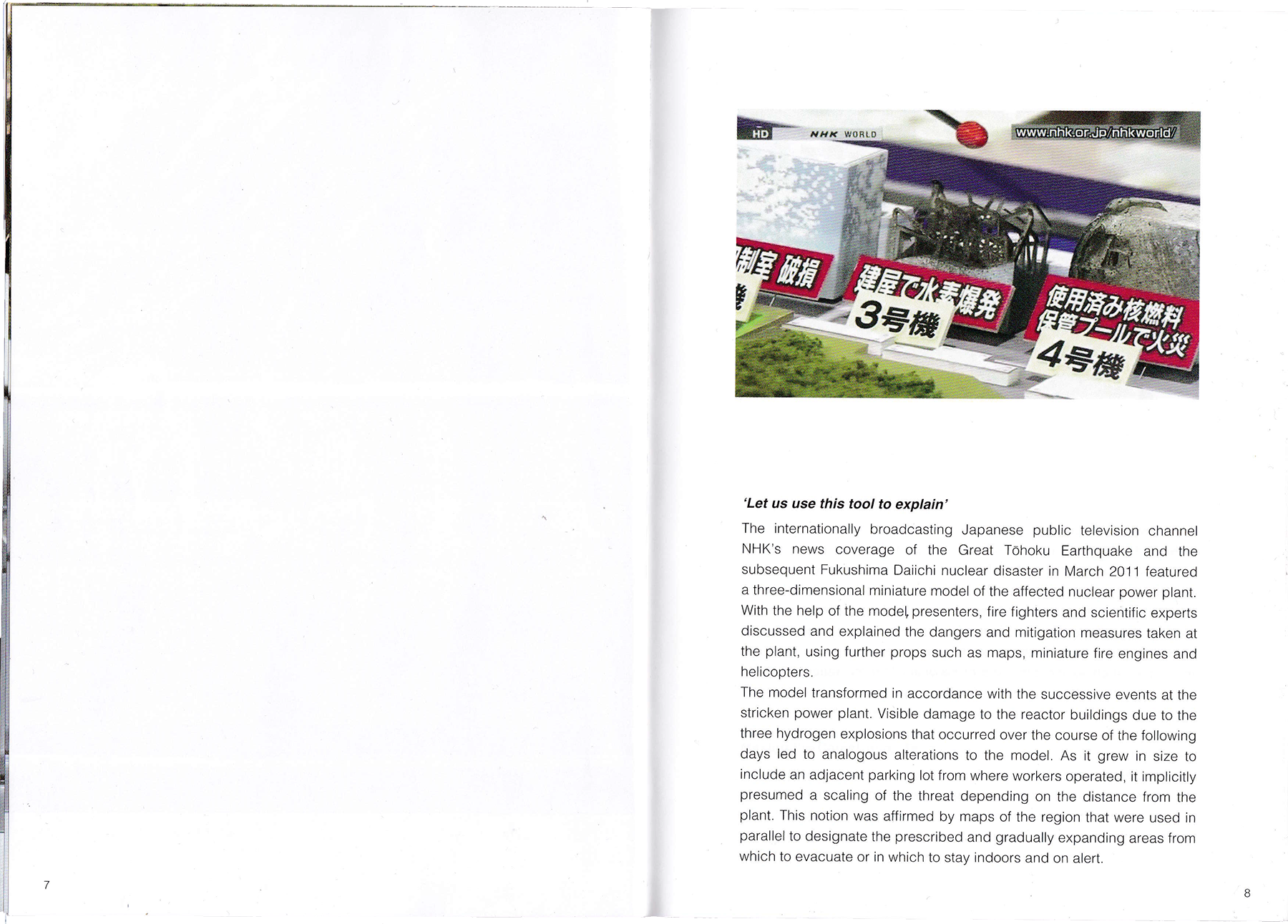
[EN]
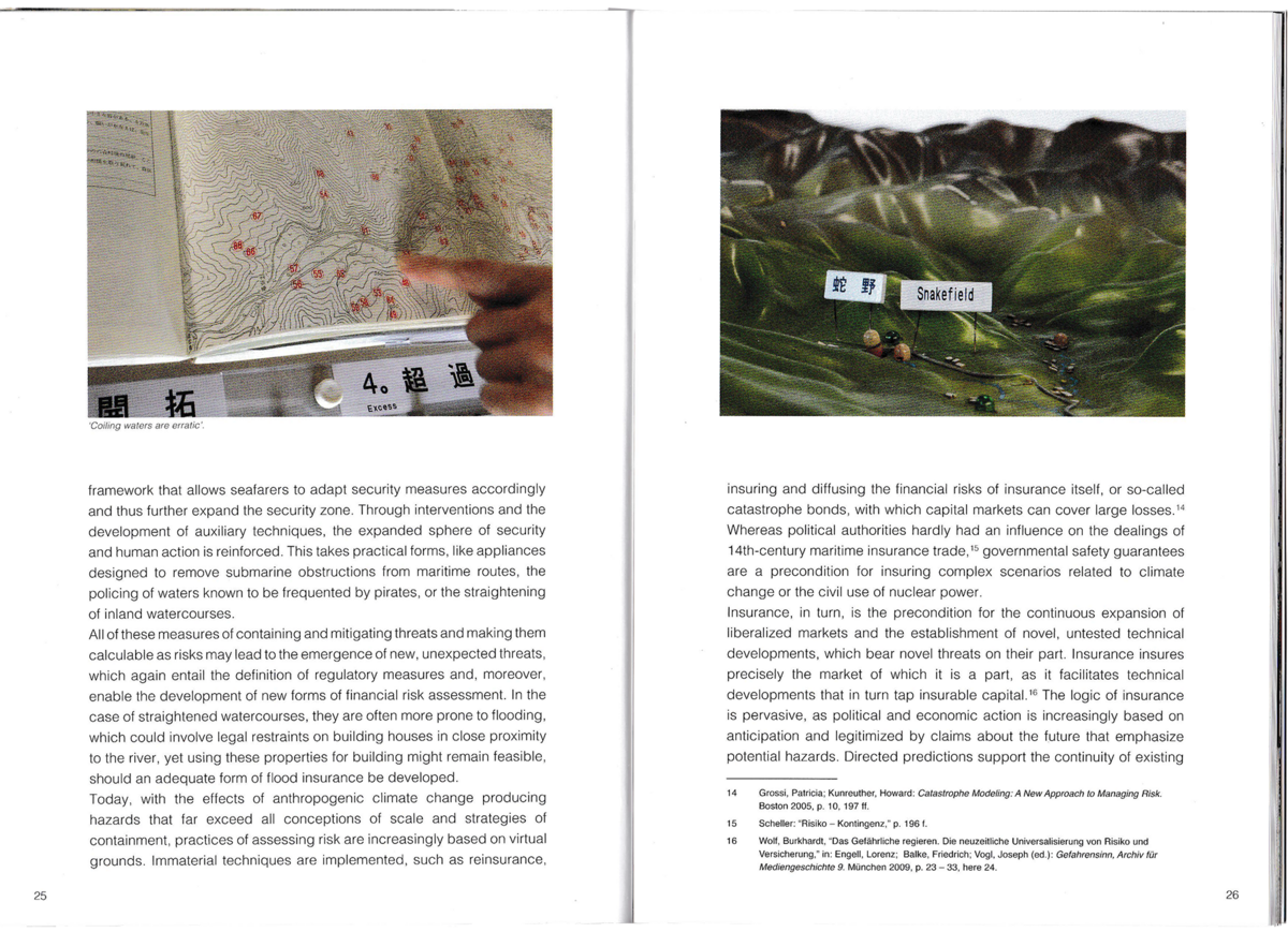
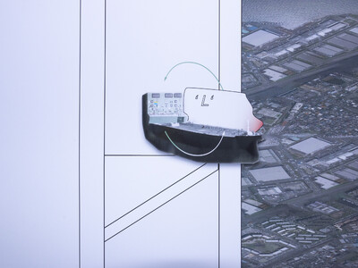
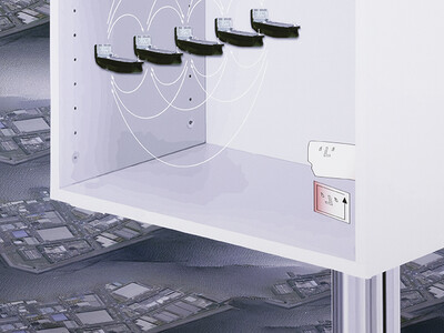
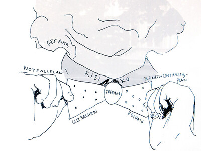
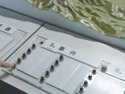
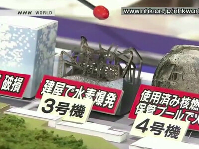
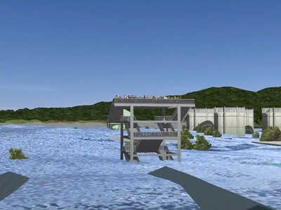
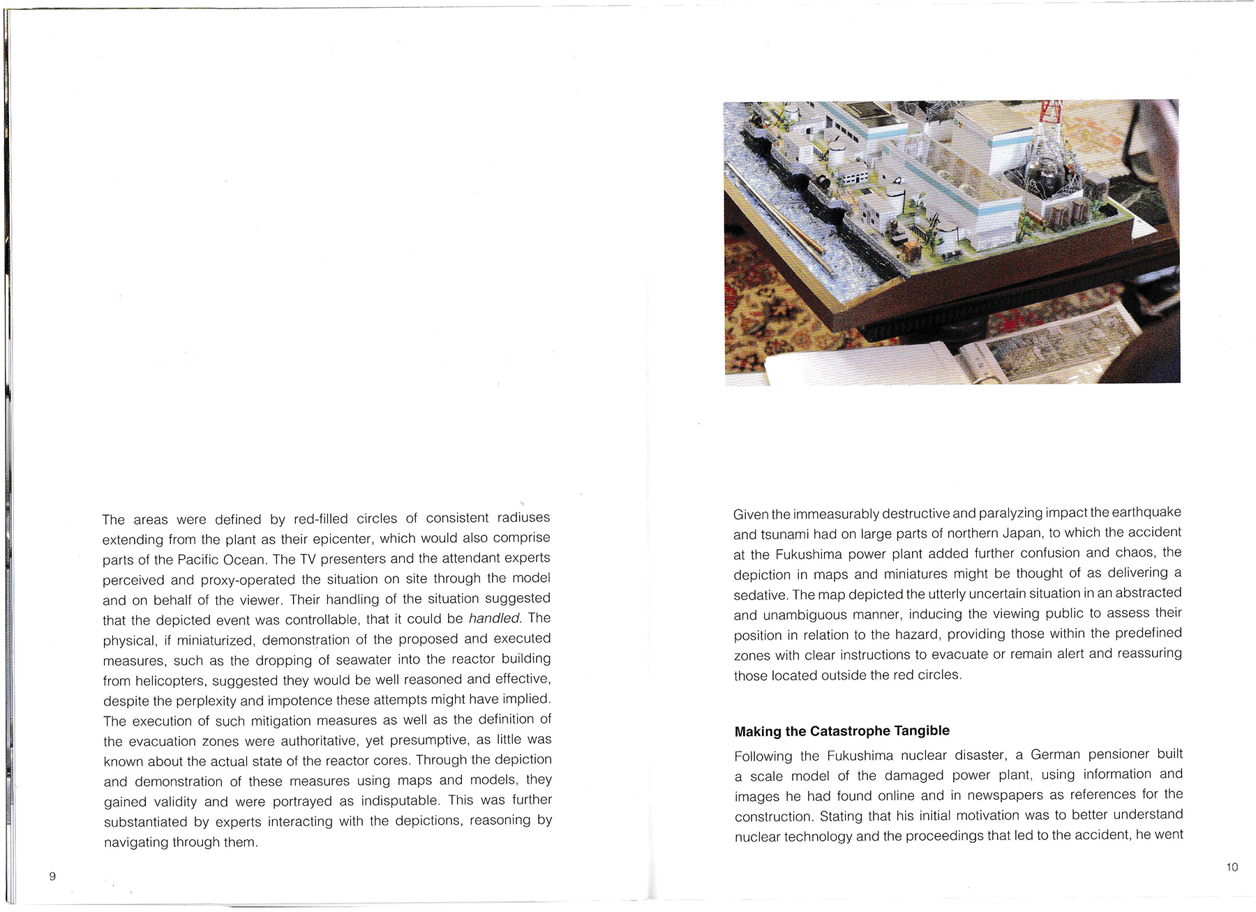
Two miniature models of the damaged Fukushima power plant are taken as the starting point for a reflection on the means of defining, localizing and visualizing risk: one broadcast live on the Japanese public television channel NHK just after the 2011 Tōhoku earthquake and tsunami had hit the plant, the other crafted in the garage of a German retiree. Cross-hatched onto maps, risks can be approached deliberately, they can either be confronted or avoided. Yet, maps tend to take effect in one direction, that is, stemming from those in power – who are in the position to compile the map, and to decide what will be depicted and what precluded – onto the governed, who use the map, accept its depiction as given and thereby validate its claims to objectivity.
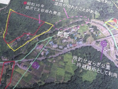
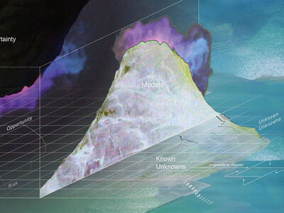
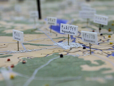
In the years since the accident the red circle circumscribing the risk zone on maps of the Fukushima region’s coastal area, has been altered according to measurements and negotiations, ensuing clean-up efforts and repopulation programs. The authorities’ objective is to diminish the zones charted as affected by the accident and to have them dissolve and disappear from the map eventually. The text suggests to approach maps not as given, scaled-down versions of reality, but as both processing tools and moldable material. Participatory mapping practices enable communities to identify threats inherent to their local context and to review and challenge the safety claims posed by official risk models and maps.
The books can be obtained directly from the publisher or from one of the stores listed here.
Furthermore, it is available in libraries in Berlin, Leipzig, Frankfurt as well as Munich.
Please see this link for details.
A Japanese version has been published in parallel.
日本語訳が発行された。
[DE]
Zwei Miniaturmodelle des havarierten Kernkraftwerkes in Fukushima, Japan, sind Ausgangspunkt für eine Reflexion der Mittel Risiko zu definieren, zu lokalisieren und zu visualisieren. In Karten einschraffiert, kann mit Risiken bewusst umgegangen werden, kann man sich ihnen aussetzen oder sie meiden. Derweil tendieren Karten dazu, einseitig zu wirken, ausgehend von ihren Autoren — in der Position sie zu erstellen, zu entscheiden, welche Informationen dargestellt und welche ausgeschlossen werden — hin zu ihren Rezipienten, die die Karten benutzen, ihre Darstellungen als gegeben anerkennen und so ihren Objektivitätsanspruch bekräftigen.
Der ikonische rote Kreis, der auf Karten zunächst jene Gebiete um das havarierte Kernkraftwerk auswies, aus denen weite Teile der Bevölkerung evakuieren mussten, wurde nach und nach modifiziert. Gemäß lokalen Messungen und Verhandlungen wurden Dekontaminierungsmaßnahmen und Wiederansiedlungsprogramme initiiert. Anspruch der Behörden ist es, den initialen Kreis, der die darinliegenden Gebiete als betroffen definiert, zu verkleinern, bis er zuletzt ganz von der Karte verschwindet. Der hier veröffentlichte Text legt Nahe Karten nicht als gegebene, verkleinerte Versionen der Realität zu verstehen, sondern als Werkzeuge zur Verarbeitung, bzw. als zu verarbeitendes, formbares Material selbst. Partizipative Kartierungspraktiken ermöglichen es Gemeinden ihren lokalen Kontexten inhärente Bedrohungen zu identifizieren, die von Risikomodellen und -karten ausgehenden Sicherheitsbehauptungen zu prüfen und gegebenenfalls in Frage zu stellen.
Das Buch kann direkt beim Verlag oder bei einem der hier gelisteten Buchläden erworben werden.
Außerdem ist es in Bibliotheken in Berlin, Leipzig, München sowie Frankfurt erhältlich.Folgen Sie hierfür diesem Link.